Marathon’s “shakedown” cruise in the Sea of Cortez started in La Paz on 7 April 2018 and ended in La Paz on 5 May 2018. It was a great adventure and we learned some important things about the boat and its systems. The overall objective was to head north, check out boat systems and our approaches to sailing and eat as much of the stored food on Marathon as possible.
Here is a quick trip summary noting where we stopped, what the author liked and what might be done differently next time.
Our first night was in Caleta Partida after leaving La Paz at the crack of noon. We had intended to head for Playa Bonanza because of predicted westerly winds but the wind was clearly from the NE, the skies were clear and whales were cavorting around us. We sailed nearly all the way.
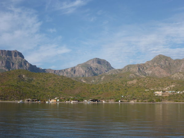
Anchorage and Beach at San Evaristo
To San Evaristo
Leaving Caleta Partida the following day we were delighted to encounter southerly winds which blew us north so quickly that we changed our planned destination from Isla San Francisco to San Evaristo. This was mostly a good idea as we were making our way north as quickly as possible, following the advice of Terry and Heidi on Cetus. The only bad news was our arrival time in San Evaristo meant we were the second to last boat to arrive and we were not in the best location to avoid the southerly swell coming into the anchorage overnight. Everything in the boat moved at some point during the night with a few things hitting the cabin floor.

Los Gatos
To Los Gatos
We continued to be driven north by southerly winds the following day and arrived in Los Gatos late afternoon. We discovered several “leak” issues in the engine compartment prior to departing from San Evaristo. The fuel filter filler pump was continuing to leak, the valve at the base of the fuel tank was continuing to leak, the raw water pump was also leaking. The alternator belt was squeaking because a nut had come loose and fallen into the engine bilge but fortunately was found, re-installed and after the belt was tightened the annoying chirping noise from the alternator belt was eliminated. Diesel continued to leak into the bilge but fortunately at a very slow rate.
En Route to Aqua Verde – Life is difficult
Aqua Verde
To Aqua Verde
We motor sailed to Aqua Verde and arrived in the early afternoon. The only excitement enroute was a pressure water line coming loose inside the galley resulting in quite a lot of precious fresh water in the bilge. This water leak along with the other leak issues was addressed after arrival. Fixing the raw water pump was easy with the installation of a new gasket under the impeller cover. The detached freshwater pressure hose was surprisingly easy to access and re-attach. The diesel leaks were and are much more challenging.
Aqua Verde is a very pretty anchorage and with mostly reasonable protection if you can get into the right spot. It is a very popular place so finding and anchoring in the right spot may not be easy. My impression is that it is not a great anchorage in north winds. The beach is also very busy with campers and local pangas coming and going much of the day. One of its apparent advantages that we did not explore is a small tienda that sells basic supplies.
To Puerto Escondido
Big northerly winds were being forecast to arrive in a few days so we headed for the marina in Puerto Escondido. This is a good marina in a very scenic location. Not cheap to tie up to a dock but the mooring balls are reasonable and provide access to all marina facilities on shore. When the wind did blow (up to 30kts coming through the marina), getting to shore from a mooring ball was not without significant challenges so many people opted to stay put. The Marina then provided a shuttle service for those who might want to come in but did not want to use their dinghy to do so. The small tienda is very well stocked and the restaurant is good and reasonably priced. Going to Loreto is possible via a rental car or by “hitch-hiking” a ride with someone in the marina who has a car or who has rented one. A ride can be requested during the daily 8AM net on Ch22. A rental car is US$40 for the day and is inclusive except for fuel.
Karen from “Snowaway” suggested that we tackle the diesel leaks with “Rescue Tape”. We have quite a lot on board and after the first attempt failed, a more aggressive approach with 5 layers of tape held out for the balance of the trip. Good stuff and thank you Karen!
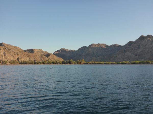
To Punta Colorado.
We booked the marina slip from Thursday to Monday based on early weather forecasts that suggested this duration for significant northerly winds. The wind actually died down by Saturday night but since we had already paid for Sunday, we stuck with the planned Monday departure and headed out of the marina for Punta Colorado on the east side of Isla Carmen. Once out of the confines of the marina however, the wind was much stronger and from a completely different direction than forecast. Wind speed was up to 23kts and the boat was moving along briskly at up to 7.2kts. At one point we believed that it might be better to go somewhere other than Punta Colorado because the forecast winds were definitely not from the west and getting there for a comfortable night might be challenging. So we started for somewhere else – precisely where was not completely clear. After studying options on the chart and in the cruising guide, it seemed that Colorado was really the best bet so we reversed directions and sailed between Isla Carmen and Isla Danzante to get to the east side of Carmen. We anchored at Punta Colorado which was very pretty but subject to overnight swell from somewhere.
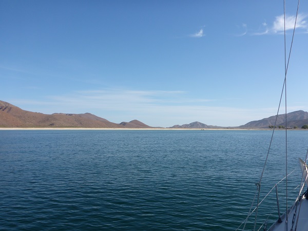
Salinas – huge! Looking north-west across the salt flats.
To Salinas
The next morning we were treated to a Bighorn sheep on the beach prior to heading off for Salinas. This anchorage is huge and though we considered one of the smaller anchorages at the northeastern edge, there was already a boat in it so we kept going into the main anchorage. This was a good place – northerly wind is not abated much by the land but there is no swell if the wind is from any northerly direction. Would not be a good place to be in southerly winds. Only a couple of boats in the anchorage at any time and the abandoned salt works on shore are interesting. We liked it enough to stay for 2 nights.
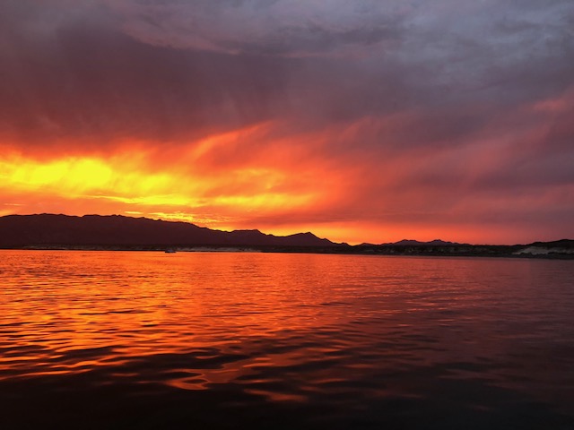
Sunset – Isla Coronados
To Isla Coronados.
Lots of experienced Sea of Cortez Cruisers rave about this place and with good reason. It is well protected (26kts coming through at times but good holding and no fetch), very scenic and offers some interesting onshore walking opportunities, including a volcanic cone ascent. Dolphins were playing in the anchorage and though there may have been up to 10 boats at one point, the place is huge and it would be hard to read the name on a nearest neighbour’s boat. I would put this place into my “highly recommended” category and we liked it so much that we stayed for 2 nights.
To San Juanico
Motor sailing to San Juanico took up much of the day after leaving Isla Coronados. This is a very beautiful anchorage with lots to see and do on shore. For most of the time, the only people on shore were from boats in the anchorage. While there, that number hovered around 10. We stayed a week! Longer would be fine but finding the exact right place to anchor is important as there seems to be a propensity for easterly and south easterly winds to start up and blow all day. The wind stops early evening but the wind generated waves do not.
To Puerto Ballandra
Beautiful, quiet and very peaceful anchorage. The water can get shallow fast and anchoring on the narrow band of suitable locations is made easier if there are only a few boats there. If the wind blows from the west overnight, it gets very bumpy inside the anchorage. We stayed 2 nights in order to prepare for the overnight sail back to somewhere near La Paz.
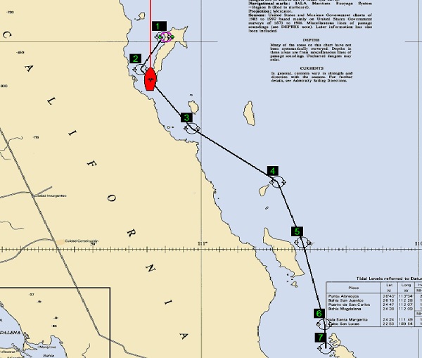
Planned Route for Overnight Sail
On the morning of departure for Espirito Santo (2 May), we were in some pretty shallow water because of the persistent overnight westerly wind blowing the boat towards the beach. Next time we should find a better spot to anchor.
About half way down Isla Carmen we encountered hundreds of dolphins heading north. Some broke off from the main group to come and check us out, passing immediately in front of the boat. It was amazing.
Things That Broke or Behaved Abnormally
1. The knot meter stopped working about half way through the trip. It could be that the impeller is stuck or it could be something else. I should have taken advantage of the opportunity to snorkel under the boat but water temperature was not up to my preferred level.
2. The wind meter behaved abnormally. This instrument is connected to the knot meter and the two malfunctions could be related.
3. Setting up Wanda was more difficult than previously. This is presumably because I was using the wind instrument to determine wind direction and it was providing incorrect wind direction at least some of the time.
4. Diesel leaks noted elsewhere.
The list is pretty short!
Some Thoughts for Next Time
Weather. We listened to the Sonrisa Net every morning for Geary’s weather forecasts. These are generally helpful presumably because of Geary’s immense experience and knowledge regarding the interpretation of weather forecast information from various sources to make them useful at a local level. However, they do not provide much advice regarding timing – i.e., when will the wind start to blow and when will it stop. Direction and strength was generally pretty good. We also used a standard subscription to PredictWind which we accessed using the IridiumGo (note: installing the external antenna made a huge difference to the IridiumGo’s functionality – it always had 5 bars). The PredictWind “PWE” forecast model seemed to be accurate more often than not if compared to actual and then experienced weather. Using a combination of these two sources was helpful and having the Iridium access was really helpful for those mornings when it was really difficult or impossible to hear Geary’s forecast for where we were.
Navigation. Marathon has the following on board to support navigation in the Sea of Cortez:
i. A Furuno chart plotter with C-Map charts;
ii. Two iPads with Blue Latitude charts for the Sea of Cortez;
iii. Paper charts (Bellingham Chart Printers) for the Sea of Cortez;
iv. Maptech Charts on a laptop with a Garmin “puck” GPS; and
v. OpenCPN and CM93 charts.
We did not use OpenCPN but we did use everything else. The Blue Latitude charts are great for anchorages but lack required detail for the water in between. The C-Map charts (vector) require regular offset adjustment in order to provide accuracy for particular areas. They do have details required for safe navigation but do not always provide accurate vessel location information. If the offset has not been adjusted for a particular region (using radar or an observable geographic feature) it is not unusual for the chartplotter to depict the vessel as being on land.
The Maptech charts (raster), viewed using Ocean Navigator Lite (supplied by Maptech) are electronic representations of the paper charts that we had on board. Vessel location accuracy was variable but sometimes showed us as being on land and I could not find a way to offset the chart to fit reality.
Navionics charts are available for this region via iNavX and possibly via SD card for use on a laptop. For the cost, it would be worthwhile trying these.
OpenCPN and the CM93 charts will also be tried but because the CM93 charts are bootleg CMap charts, it is not likely that this combination will be any more accurate than the Furuno chartplotter and the CMap charts currently in use.
Examining Google Earth images back at home did not reveal some of the known hazards that are not plotted on any of the above charts and some that are. Thus, programs such as SASPlanet and GE2KAP may not be helpful, particularly because the Blue Latitude charts are so good for anchorages.
The prudent sailor should always use multiple sources of navigational information including eyeballs. It is not likely that every rock in the Sea of Cortez has been charted so we should always be prepared for surprises.
Food. We had a lot of food on board and eating it was one of the objectives of the cruise. We should have been more mindful of meal plans prior to departure because by the time we returned to La Paz, we had eaten a lot of the food in the freezer but not all of it.
Water. We were very careful with water usage but we still used more than was really necessary. It will be important to install the plumbing for the freshwater foot pump in the head to minimize use of the pressure water system which tends to be wasteful. We refilled the water tanks in Puerto Escondido and as a result did not need to run the water maker until we were just about to leave San Juanico.
Power. We were careful with power usage and day length seemed to be adequate for the solar panels to keep the batteries well charged. Generally the batteries were full by about noon on sunny days and later in the afternoon on cloudy days. It is not clear what impact the water maker would have on a cloudy day. Sunny days, with similar day length (sunrise: approx. 6AM; sunset approx. 7PM) should provide lots of power for the batteries which at the time of writing are about 1 year old.
Daily Routine. Adopting the SV Voyageur 10.10 systems monitoring approach would be a good idea. Vital fluids, location, weather, etc, are monitored at regular intervals.
Jacklines and Other Safety Items. The single jackline system running up the middle of the boat seemed to work well and will minimize the possibility of a tethered crewmember from going overboard if they are wearing a 3 clip tether with long and short arms. When we came up from below, we were able to easily clip in to the padeyes in the companion way, move to the wire jackline in the cockpit or shift to the permanent tether attached to the transition rope jackline between the cockpit and the yellow webbing jackline in front of the dodger which allows movement to the front of the boat.